From Postcode to Professional PDF
in Under 10 Minutes
Step 1
Enter your postcode
We locate your property using satellite mapping. Your plot boundaries, orientation, and surroundings are captured automatically.
Step 2
Select your house type
Choose from pre-built templates: semi-detached, detached, terraced, or bungalow. PLANIT loads a base model matched to your property.
Step 3
Configure your existing plans and your new extension
Use intuitive push-pull controls. Set depth, width, roof type, glazing. See changes update live in a floor plan diagram.
Step 4
Instant compliance check
PLANIT runs your design against all Permitted Development rules for England. Green means go. Amber flags items for attention.
Step 5
Download your drawings
10 professional drawing sheets — PDF format, PLANIT-branded, ready for your planning submission.
A Real-Time Calculation Engine.
Not a Checklist.
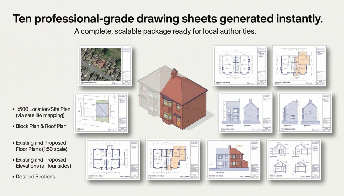
10 Professional Drawing Sheets
A complete, scalable package ready for local authorities.
Be First. Get Early Access.
Join the waitlist and be among the first to use PLANIT when we launch.